 David Overton Trail
Location: Coram, NY
Size: 450 acres
Date of hike: May 27, 2017
The preserve has entrances on Granny Road, Mill Road and Route 112, the former of which was where I parked. It was near the intersection with Middle Island Road and had a gravelly patch large to fit half a dozen cars or so. Upon parking, I read on the website All Trails that the preserve has a 3.9-mile loop path, but I decided to just wander. And since there was no trail map online or in the parking area, I used my geocaching app to follow my whereabouts. I started by walking north along a paved path named David Overton Road that had openings in the greenery to access the forest. Immediately, I realized the preserve is a popular spot for mountain biking as the trail markers all displayed images of bicycles. From what I read, there are four levels of difficulty. The easiest trails feature a green circle, then a blue square for moderate routes, and single and double black diamonds for the most challenging paths.
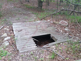
The hike's highlights for me were seeing the cool objects scattered throughout the property. For example, the first item I encountered was an old military-looking weapon on two wheels. I later came across an abandoned pickup truck with "smoke pot" written in red spray paint, and then a broken boat just sitting amidst the sea of trees as if a tornado dropped it at that very site. But the best stuff was the makeshift structures and barriers used for paintballing – including wooden platforms, rusty barrels and fragments of fences propped up for protection against incoming fire. My research revealed the land was once used by Cousins Paintball, according to Newsday. But all that remains now are its apocalyptic remnants. It's chilling.
Regarding wildlife, the property is home to a variety of birds like bobwhites, scarlet tanagers and myriad warblers, according to LIParks.com. However, all I saw on this day were deer. The forest is so dense that, if you're quiet, you can get pretty close before they see you. The wooded density
also provided a lot of privacy enabling me to intensely headbang to Australian progressive metal group Voyager, which recently released their sixth record, Ghost Mile. My favorite song is probably the second track, "Misery is
Only Company."
In closing, I definitely recommend that local hikers and bikers visit the David Overton Trail. The property offers a unique mix of man and nature that you don't find in other preserves. There's also so much stuff hidden within it that I feel like I barely scratched
the surface. Thank you to my late friend for guiding me
toward Overton. Rest in peace, Dominick.
(Updated: Dec. 23, 2018)
(Updated: Dec. 23, 2018)
Map: David Overton Trail (Google Maps image)
Parking: 40°50'55.5"N 72°59'13.8"W
Video: David Overton Trail (360-degree view)


Parking: 40°50'55.5"N 72°59'13.8"W
Video: David Overton Trail (360-degree view)


Thank you so much for taking the time to share all this information and lovely photos. It's a very large public service which I really appreciate.
ReplyDeleteWhat road is the entrance and parking on for David Overton Preserve?
ReplyDeleteDavid Overton Rd, which is off of Granny Rd, which is off of NY-112, north of the LIE Exit 64
Deletenice review- Mike... nice to know I can roam around without the need to walk on the mountain bicycle trails....
DeleteHi, don't know if you'll see this but was wondering if you saw the giant satellite dish that is about 0.9miles SSW of the trail entrance, and maybe knew what it was? The coordinates are 40.851583, -72.994480
ReplyDeleteThat area looks like the last place I’d hike!
ReplyDelete