 West Hills County Park
Location: Melville, NY
Size: 854 acres
West Hills County Park features a hilly forest once frequented by the legendary poet Walt Whitman and also boasts the highest point on Long Island. I'd always thought the highest point was Bald Hill in Farmingville, but apparently that distinction goes to Jayne's Hill, which has an elevation of 401 feet. Once I learned that tidbit, I knew I needed to visit it. I mean, how can I call myself a diehard hiker if I haven't even scaled the "summit" of Long Island? West Hills, here I come!
Before exploring, I learned more about the history and habitats of West Hills County Park, which was formed by the southward advance of a giant ice sheet around 60,000 years ago. "Acting like a conveyor belt, a bulldozer and a sled, the glacier scoured the mountains and valleys of New England, transporting the crushed material southward to the point where you now stand," stated a sign near the visitor's center. "The glacier couldn't go any further south due to the moderating climate." During the early and mid 1900s, much of the park's western section was known as "Highhold" and served as the estate of Henry L. Stimson, who served as the Secretary of State under U.S. President Herbert Hoover and Secretary of War under U.S. Presidents William Howard Taft, Franklin D. Roosevelt and Harry S. Truman. He also hosted his well-known "Highhold Games," which included equestrian events and fox hunts, on the property each Thanksgiving. The land was transferred after the passing of Stimson's wife Mabel to the Greater New York Councils of the Boy Scouts of America and used as a camp for many years before being sold to Suffolk County in 1975. In fact, it's still open to organized camp groups and also offers horses that are privately owned and leased from the on-site Sweet Hills Stables. Lastly, for those wondering, leashed dogs are allowed.
The park's main entrance is located on the east side of Sweet Hollow Road just north of the Northern State Parkway, but there are several entry points. I divided the property into three sections: the section east of Sweet Hollow Road, the section west of Sweet Hollow Road, and the section south of the Northern State Parkway. The first section, which is east of Sweet Hollow Road, can be reached using the main entrance and features an equestrian center, a big dog run, and hiking trails that overlook NY Route 110 and lead to Jayne's Hill. The second section, which is west of Sweet Hollow Road, contains a small dog run and a path called the Red Dot Trail, which I hiked in under two hours and began in a gravelly lot along the north side of Highhold Drive. The third section, which is south of the Northern State Parkway, is also called Mount Misery Nature Preserve and legends say a woman named Mary killed her family with a hatchet there. (This preserve has its own blog entry.) "Mary's ghost is said to still haunt these woods," said the Town of Huntington's trail guide.
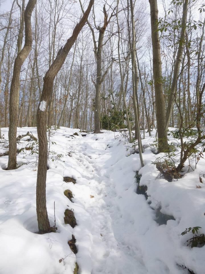
The hike's highlights for me included Jayne's Hill and and the history of poet Walt Whitman, whose poem "Paumanok" was posted on a rock atop the hill. Unfortunately, it was marred with graffiti, but it was still a thrill to get there. If you're looking for a shortcut to Jayne's Hill, drive to the end of Reservoir Road and hike behind the water tower on the street's west side. I should also note there's a 3.7-mile Walt Whitman Trail, which is marked with white blazes. That path starts "near the top of Reservoir Road and winds through West Hills County Park," according to the Long Island Greenbelt Trail Conference. For those wanting more Whitman, his birth site is on nearby Old Walt Whitman Road. "West Hills is a romantic and beautiful spot," he once said, according to a sign. "Its high hill affords extensive and pleasant views."
Regarding wildlife, you'll find everything from salamanders to red foxes to hairy woodpeckers, while the park's plants range from mountain laurel to moccasin flowers to a few fern species. The park is also a popular spot for horseback riding, with about a dozen horses passing me on this winter day. It made me wonder why we pick up after dogs, but not horses. I mean, equine can drop some bombs. Speaking of bombs, my hiking music was Fates Warning's explosive new disc, Darkness in a Different Light. Check out "And Yet It Moves." It slays!
Overall, I'd say that West Hills County Park is a must-see spot for all hikers on Long Island, although I wish there wasn't a big water tower at the highest point. Even so, I can see why these woods inspired one of our nation's most famous poets. Rest in peace, Mr. Whitman.
(Updated: Dec. 6, 2020)
Map: West Hills County Park ( Google Maps image)Parking: 40°48'06.6"N 73°25'16.7"W
Video: West Hills County Park (360-degree view)


The spectacular view in this area is in the southern section of the park. Park across from the cemetery and go west up the hill, then head northwest for about 15 minutes (the view is looking east.) This view of epic proportions is best experienced in the winter months.
ReplyDeleteThe spectacular view in this area is in the southern section of the park. Park across from the cemetery and go west up the hill, then head northwest for about 15 minutes (the view is looking east.) This view of epic proportions is best experienced in the winter months.
ReplyDeleteThis is a great article with fantastic photos.
ReplyDelete