 Kings Park Bluff
Location: Kings Park, NY
Size: 300 acres
Date of hike: June 24, 2017
Kings Park Bluff was an instant favorite for me. For hikers, it offers a series of sandy trails atop a beautiful bluff where the Nissequogue River meets the Smithtown Bay. I first visited it three years ago when I hiked the Long Island Greenbelt Trail, a 32-mile trail that spans north to south (or south to north) across Long Island. Since I had traveled south to north, the Greenbelt passed through the bluff before ending at Sunken Meadow State Park. But, with the sun setting, I walked fast without fully enjoying the views. Well, I decided it was time to enjoy them once and for all.
The bluff's entrance is at the end of Old Dock Road and just to the west of the Old Dock Inn, an old-fashioned steak and seafood restaurant. Since I'm not a Town of Smithtown resident, a teenage boy manning the entrance told me to park in one of the spaces leading up to the bluff along the west side of Old Dock Road. While some spaces seemed to be reserved for town residents with boat trailers, the batch of spaces furthest from the entrance didn't have any restrictions, and so I parked there amongst a handful of other cars whose owners were likely in the same boat (pun intended). Before exploring, I did a little pre-hike research on my phone to learn more about the bluff's history and habitats. To my surprise, I didn't find anything of substance – not even the bluff's approximate acreage, which I estimated above. Also, I could be wrong, but it looks on Google Maps like the bluff is actually part of Sunken Meadow State Park, despite having an entrance separate from the park itself. Whether it's part of the park or not, I have decided to give the bluff its very own blog entry. It deserves it.
Upon exiting my jeep, the first thing I saw was a small sign for a Sunken Meadow dog path, which was adjacent to the very last parking space along Old Dock Road. I later learned the dog path is a back entrance to the bluff while also leading to Sunken Meadow State Park if you take that trail west. However, I decided to just walk to the water along Old Dock Road. The views were insane, just as I remembered from when I hiked the Greenbelt Trail in 2014. To the right a bevy of boats were anchored in the picturesque river beside the Old Dock Inn, while to the left is my favorite part: the bluff. But we'll get to that shortly. It's worth the wait. Straight ahead, only a stone's throw across the water, is Short Beach. Although the beach seems close in proximity, to get there you must travel a few miles southeast and cross the river at Landing Avenue. It's at the end of Boney Lane, which becomes Short Beach Road.
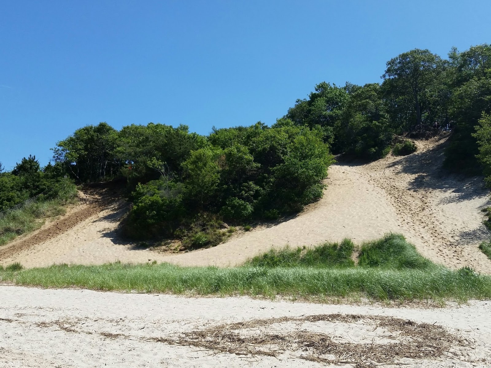
My first stop was a short boardwalk overlooking the water. It was a popular spot with several cars parked beside it and families relaxing on benches or, in some cases, using lawn chairs right on the boardwalk. Instead of heading down to the beach though I beelined for the bluff, which can be accessed using a makeshift staircase located near the rear of the parking lot. Keep an eye out for the white blazes that represent the Greenbelt Trail and just follow them right up the bluff. Then prepare for your jaw to drop. The trail winds along the bluff top with periodic gaps in the trees offering unreal views. Changing tides sculpt the sand below into peninsulas that stretch or shrink depending on the time of day. It felt like a tropical island.
I followed the white blazes all the way to a parking lot inside of Sunken Meadow State Park. It took about a half hour, with several smaller trails branching off to zigzag down to the water. Instead of taking the same trail back, I made my way down to the bluff's bottom. Boy, what a terrific decision it was. I highly recommend everyone hike both the bluff's top and bottom. One of the hike's highlights for me was a little bridge at the bottom of the bluff that crosses over the Sunken Meadow Creek and heads to the heart of the state park. But I decided to save that part for a future hike. After all, the bluff had supplied enough beauty for one day.
As I leisurely retreated to the parking lot, I experienced a deep peace I've felt multiple times while hiking. A tiny crab with an oversized claw stopped to watch me embrace the moment. I'll never forget it. I stooped to snap a quick pic of him as we engaged in our staring contest. Also, helping to set the mood was Tesseract's 2013 album Altered State, which is likely my favorite release from the past five years. The track "Exile" is just pure magic. Check it out.
All in all, I'd say all local hikers should visit Kings Park Bluff. The views are simply too good to miss and the trails are too unique to ignore. It's like a mini paradise. And, of course, feel free to grab a post-hike bite at the Old Dock Inn. They say the food is as good as the views.
(Updated: Aug. 4, 2019)
Map: Kings Park Bluff (Google Maps image)
Parking: 40°54'11.6"N 73°14'04.2"W
Video: Kings Park Bluff (360-degree view)


Great site and blog. Thank you for this! Will be exploring Kings Park bluff myself next. Cheers from a fellow prog-metal head
ReplyDeleteThank you so much for the parking information, that's truly useful for non-resident of smithtown.
ReplyDeleteAlso very nice detailed blogging of the trails and pictures, much appreciated!
Thanks so much!
ReplyDeleteI love all of your reviews. I'm familiar with some as a mountain biker and fat biker but really want to explore the kings park and nissequogue areas. Great write ups! Helpful info
ReplyDeleteFYI, the Bluff is definitely dog friendly with the dog walk entrance right there on Old Dock Road. Like you, I'm just not sure where the Bluff ends and Sunken Meadow State Park begins (which is not dog friendly).
ReplyDeleteThanks for posting and for the gorgeous photos!
ReplyDelete